

When people think of Vietnam’s rocky highlands, Ha Giang instantly comes to mind — a region of rugged charm, untouched scenery, and irresistible appeal. This Ha Giang Loop travel blog isn’t just a checklist for your trip; it’s an invitation to discover emerald valleys, endless flower fields, and some of the most spectacular mountain roads in the country.
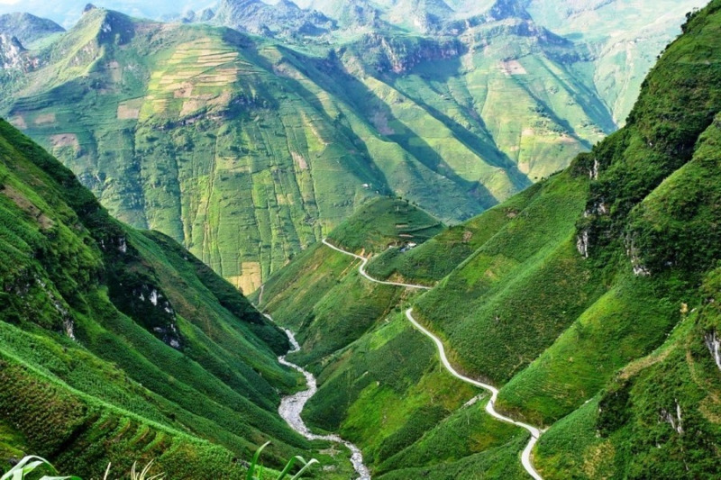
The Ha Giang loop captivates travelers with its ever-changing scenery. Beginning in Ha Giang City, you’re greeted by lush green landscapes dotted with tranquil ethnic villages. The deeper you go, the scenery transforms into layers of limestone peaks — the signature “cat-ear” cliffs unique to the Dong Van Karst Plateau.
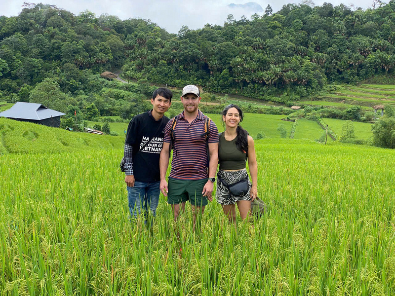
Yet Ha Giang’s magic isn’t just its geography — it’s also its people. On your journey, you can meet the H’Mong, Dao, and Lo Lo communities. Each group expresses its own heritage through distinctive houses, colorful textiles, and vibrant highland markets. Together, they create the cultural tapestry that this Ha Giang travel blog loves to showcase.
Buckwheat flower fields and highland villages in Ha Giang
The Ha Giang Loop starts in Ha Giang City and stretches across northern districts such as Quan Ba, Yen Minh, Dong Van, and Meo Vac before circling back to the city. Depending on your chosen route, the full loop covers roughly 350 – 400 km.
This road has become legendary not just within Vietnam but across the world. Many travel experts rank it among Southeast Asia’s most stunning mountain journeys thanks to its seamless blend of dramatic nature and authentic culture.
Map of the Ha Giang Loop with main stopovers highlighted
One of the most common questions is how many days you’ll need to experience the Ha Giang Loop. Most travelers spend between three and five days to fully enjoy it.
If you’re short on time, three days is enough to see highlights such as Quan Ba, Dong Van, and Meo Vac. But if you want a deeper look into local life, weaving through villages and discovering hidden corners, a four– to five–day trip will be more rewarding.
The key to Ha Giang is not to rush. This isn’t just a route to “conquer” but a journey to savor — every turn, every mountain breeze, every breathtaking view.
Exploring the full Ha Giang Loop typically takes 3 – 4 days, following Mikey Tour’s Ha Giang Loop travel blog.
Your choice of transport on the Ha Giang Loop shapes your whole experience. For young adventurers who crave freedom and adrenaline, renting a motorbike is the ultimate option. Nothing compares to leaning into each curve of the mountain passes, stopping whenever you like for photos, or simply soaking in the scenery. Small-group motorbike tours are also a great way to stay safe while making new friends on the road.
For families or groups seeking comfort and a slower pace, an SUV or car hire is a perfect fit. Traveling by car provides space, safety, and convenience — especially for children or older family members. Whether you go on two wheels or four, each choice offers a unique way to experience the stunning Ha Giang Loop.

A motorbike or SUV is suitable for this winding mountain road
Most travelers break their journey into stages. Mikey Tour recommends the following route:
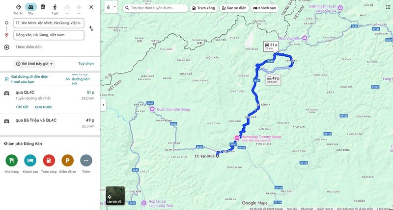
Start in Ha Giang City and ride through Quan Ba, home to the famous “Heaven’s Gate” viewpoint and the Twin Fairy Mountains. This stretch introduces you to rolling mountains and expansive valleys. End your first day in Yen Minh, often dubbed the “Little Da Lat” of northern Vietnam.
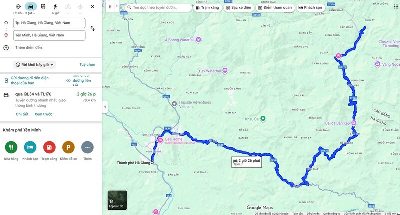
Map from Ha Giang City to Yen Minh
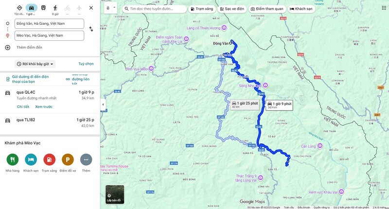
On day two, you’ll venture deeper into the Dong Van Karst Plateau. This stage highlights the area’s distinctive mud-walled houses, ethnic culture, and vibrant buckwheat, flower fields. Dong Van also offers cozy guesthouses, regional specialties, and a charming old quarter to explore by night.
Map from Yen Minh to Dong Van
This is often the most memorable day of the journey. The road from Dong Van to Meo Vac crosses Ma Pi Leng Pass — one of Vietnam’s legendary “Four Great Passes.” From the top, you can gaze down at the emerald Nho Que River snaking through the gorge below, an unforgettable sight featured in almost every Ha Giang Loop travel blog.
Map from Dong Van to Meo Vac
The final leg leads you through Du Gia, a tranquil village known for its rice terraces, waterfalls, and fresh mountain air. Many travelers stay overnight here to unwind and enjoy the stillness before heading back to Ha Giang City.
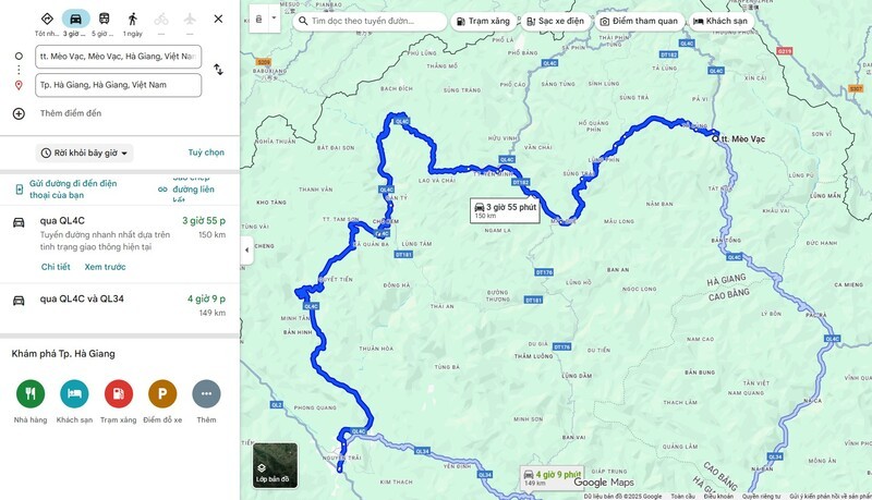
Map from Meo Vac back to Ha Giang City
This iconic viewpoint offers sweeping views of the valley below, framed by the Twin Fairy Mountains. It’s the welcoming gateway to the Dong Van Karst Plateau and a classic stop on every Ha Giang Loop travel blog.
Panoramic view from Quan Ba Heaven’s Gate
Connecting Dong Van and Meo Vac, Ma Pi Leng is a dramatic mountain pass with hairpin bends, sheer cliffs, and the Nho Que River flowing far below. Standing here, you’ll feel the raw power of northern Vietnam’s landscapes.
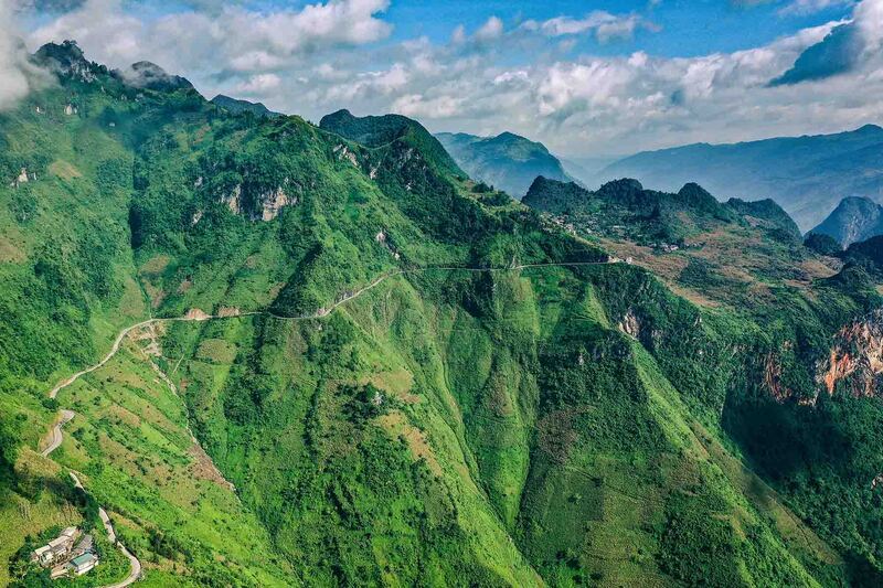
Hairpin bends of Ma Pi Leng Pass overlooking the Nho Que River
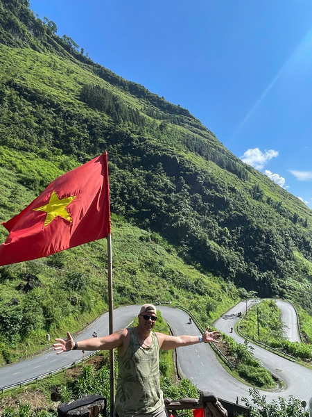
Known as the “Roof of Vietnam,” the Lung Cu Flag Tower is a powerful national symbol. Standing beneath the red flag with its yellow star fluttering above the mountains, you’ll feel a surge of pride and awe.
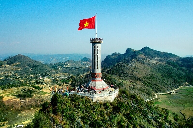
Lung Cu Flag Tower with the national flag flying high
Exploring the Ha Giang Loop is more than just a road trip — it’s an unforgettable journey of connection and discovery. Whether you’re on a motorbike savoring every curve or in a comfortable SUV with family, Ha Giang reveals new wonders at every turn.
If you prefer a seamless experience with a clear schedule, time-saving options, and built-in safety, joining a professional tour is worth considering. Established operators know every inch of the loop, handle the logistics, and ensure you can simply enjoy the ride. And of course, when reading Ha Giang Loop travel blogs, you’ll find plenty of inspiring itineraries to kick-start your own adventure.